


Local weather update
0Another wet weekend forecast!!
Two weather systems are set to collide, similar to what we saw two weekends ago with the end result of an East Coast Low. The difference this time, is that we are likely to be the least affected with just some steady, soaking ran expected.
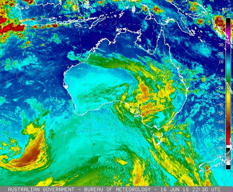
Starting Friday, an Upper trough (a cold mass of air) which is moving east across the continent will meet with a surface trough and drag moist air down into the system. We will start seeing the rain from Saturday evening and it’s expected to continue through to Sunday.
There is a chance of thunderstorms on Sunday.
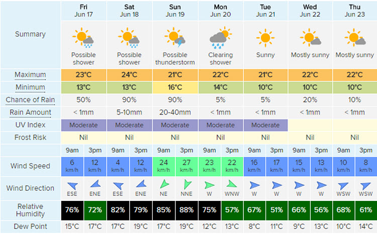
Image 1: Courtesy of Bureau of Meteorology http://www.bom.gov.au/australia/satellite
Image 2: Courtesy of Weatherzone http://www.weatherzone.com.au/